


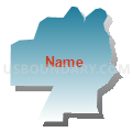
Fishtrap Voting District, Thurston County, Washington
About
Outline

Summary
| Unique Area Identifier | 689760 |
| Name | Fishtrap Voting District |
| County | Thurston County |
| State | Washington |
| Area (square miles) | 1.59 |
| Land Area (square miles) | 1.54 |
| Water Area (square miles) | 0.05 |
| % of Land Area | 96.81 |
| % of Water Area | 3.19 |
| Latitude of the Internal Point | 47.15456270 |
| Longtitude of the Internal Point | -122.85437080 |
Maps


Graphs
Select a template below for downloading or customizing gragh for Fishtrap Voting District, Thurston County, Washington


Neighbors
Neighoring Voting District (by Name) Neighboring Voting District on the Map
- Water: Henderson Inlet, Thurston County, WA
- Water: Puget Sound Con 9, Thurston County, WA
- Zangle Voting District, Thurston County, WA